
Dispatch 15: Elkhorn to Port of Fortuna
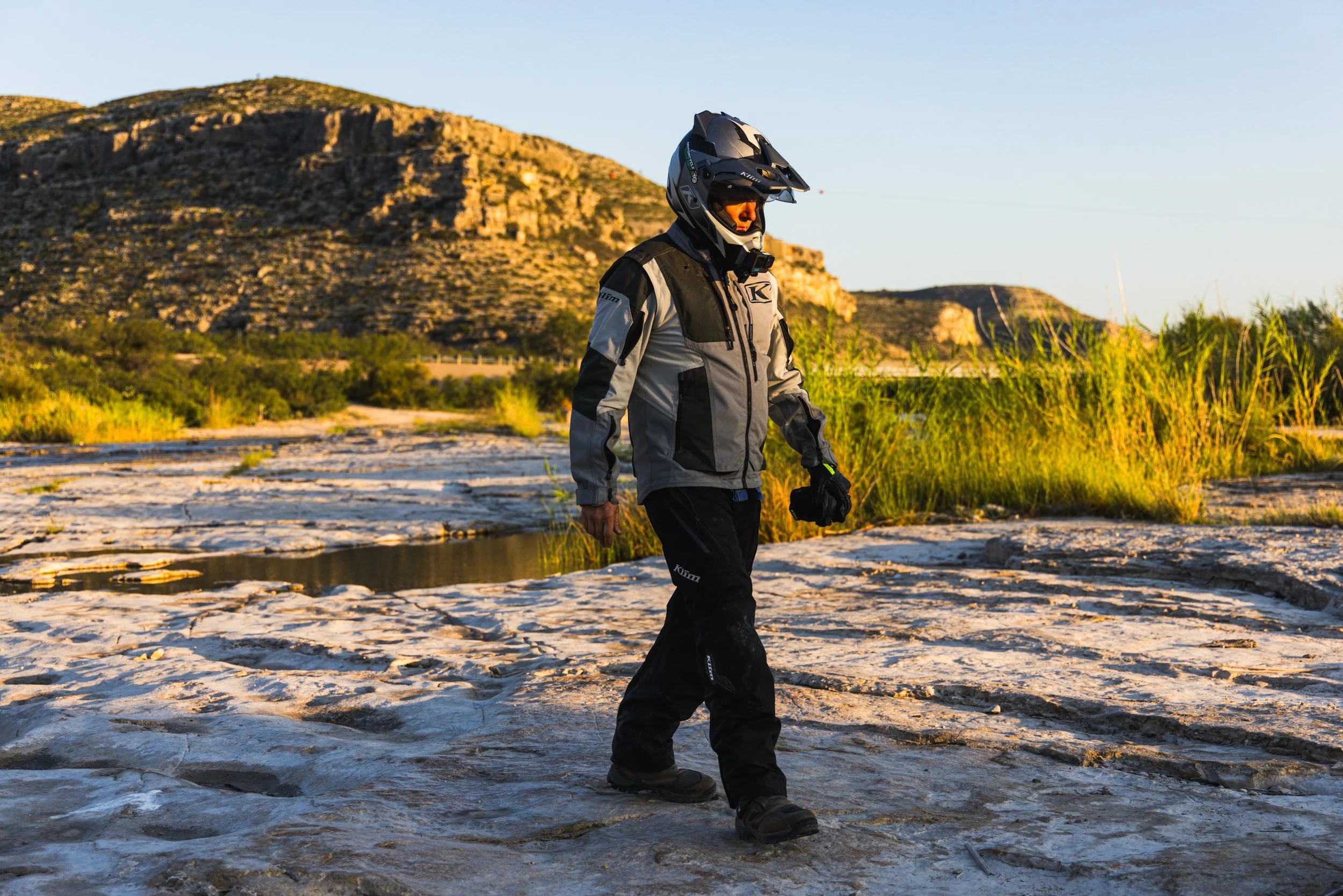
Today is our last day on motorcycles. Before this trip, I was concerned about sleeping on the ground for 15 nights, but modern camping gear is amazing. Between my sleeping pad, camp pillow, and finishing each day exhausted, I’ve slept very well, except last night. It was in the 30s, and I was frigid. This morning, I crawled out of my tent with a sore calf muscle and limped to the picnic table where Madison, one of our film directors, sat. “You okay?” She asked. I rubbed my calf. “My head is pounding, and I somehow injured myself while sleeping.” She chuckled and handed me some Liquid IV. “I think you’re dehydrated.”

Today is our last day on motorcycles. Before this trip, I was concerned about sleeping on the ground for 15 nights, but modern camping gear is amazing. Between my sleeping pad, camp pillow, and finishing each day exhausted, I’ve slept very well, except last night. It was in the 30s, and I was frigid. This morning, I crawled out of my tent with a sore calf muscle and limped to the picnic table where Madison, one of our film directors, sat. “You okay?” She asked. I rubbed my calf. “My head is pounding, and I somehow injured myself while sleeping.” She chuckled and handed me some Liquid IV. “I think you’re dehydrated.”
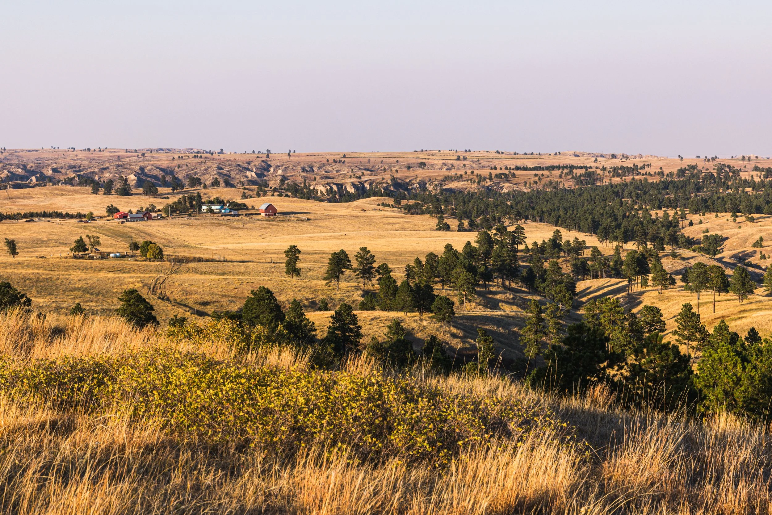
Our final miles through North Dakota’s Badlands were a display of dissected geology. We rode along a peninsula of prairie grass with layers of red dirt, limestone, and striated rock around us. As we proceeded north, the abrupt features softened into rolling hills with round bales of hay dotting the landscape.
We stopped in Cartwright and encountered the most posh convenience store of the trip. No, it wasn’t the premade breakfast empanadas from the warming tray that pushed it into luxury status. It was the robotic bidet-style toilet in the restroom. I’ll leave it at that.
Refreshed and rejuvenated, we headed towards the confluence of the Missouri and Yellowstone Rivers, where we rode to the bank and took in the massive waterways. It was time for the final push to Canada.
We pulled into the parking lot of the small and remote border crossing. The plan was to cross the border, turn around, and re-enter the United States. It was 5:39 p.m., and we discovered the U.S. side closed at 5 p.m., despite an earlier road sign indicating it closed much later. We could enter Canada, but we’d have to ride more than an hour to cross back into the U.S. Our crew was here. We wanted to finish with them, so we rode to the Canadian entrance, turned around, and finished with our team. They ran next to the bikes and cheered us all the way to the parking lot.
It was over, but this trip had been all about the journey, not the destination. I’ll never forget the people we met and the talented individuals I traveled with. I feel blessed to be a part of this exceptional team. I hope this inspires you to take the road less traveled and experience the wonders of the Great Plains. You will not be disappointed.


Dispatch 14: Buffalo, South Dakota, to Elkhorn Campground, North Dakota
Ronnie Jim Ginsbock thought he’d hit Blossoms and Brew for a quiet breakfast, but his small, local coffee shop had been taken over by our team. When Jerod and I arrived, every member of our film crew had joined a table of locals. We were introduced to Ronnie, a welder and longtime resident of Buffalo, South Dakota. Ronnie had worked as a commercial welder (agricultural, construction and oil field) but also dabbled in metal art. He was curious about our travels and spoke of his love of finding beauty off the beaten path. After chatting with Ronnie, Jerod and I sat down for breakfast. I had over-easy eggs, bacon, hash browns, and a biscuit.

I’m going to be honest with you. Jerod and I have not been completely alone on this trip. We’ve been followed by directors Simon Parmley and Madison Walker Martin and a Texas Tech University student film crew. Our travels up the Great Plains will be a docu-series on Texas Tech PBS next year.
Ronnie Jim Ginsbock thought he’d hit Blossoms and Brew for a quiet breakfast, but his small, local coffee shop had been taken over by our team. When Jerod and I arrived, every member of our film crew had joined a table of locals. We were introduced to Ronnie, a welder and longtime resident of Buffalo, South Dakota. Ronnie had worked as a commercial welder (agricultural, construction and oil field) but also dabbled in metal art. He was curious about our travels and spoke of his love of finding beauty off the beaten path. After chatting with Ronnie, Jerod and I sat down for breakfast. I had over-easy eggs, bacon, hash browns, and a biscuit.
On our way out of town, we stopped at Centennial Park to visit the Three Toes statue, a tribute to one of the last gray wolves to roam this region. From 1912 to 1925, Three Toes slaughtered livestock without discretion and ultimately met his demise in 1925 at the hands of a government trapper named Clyde Briggs.
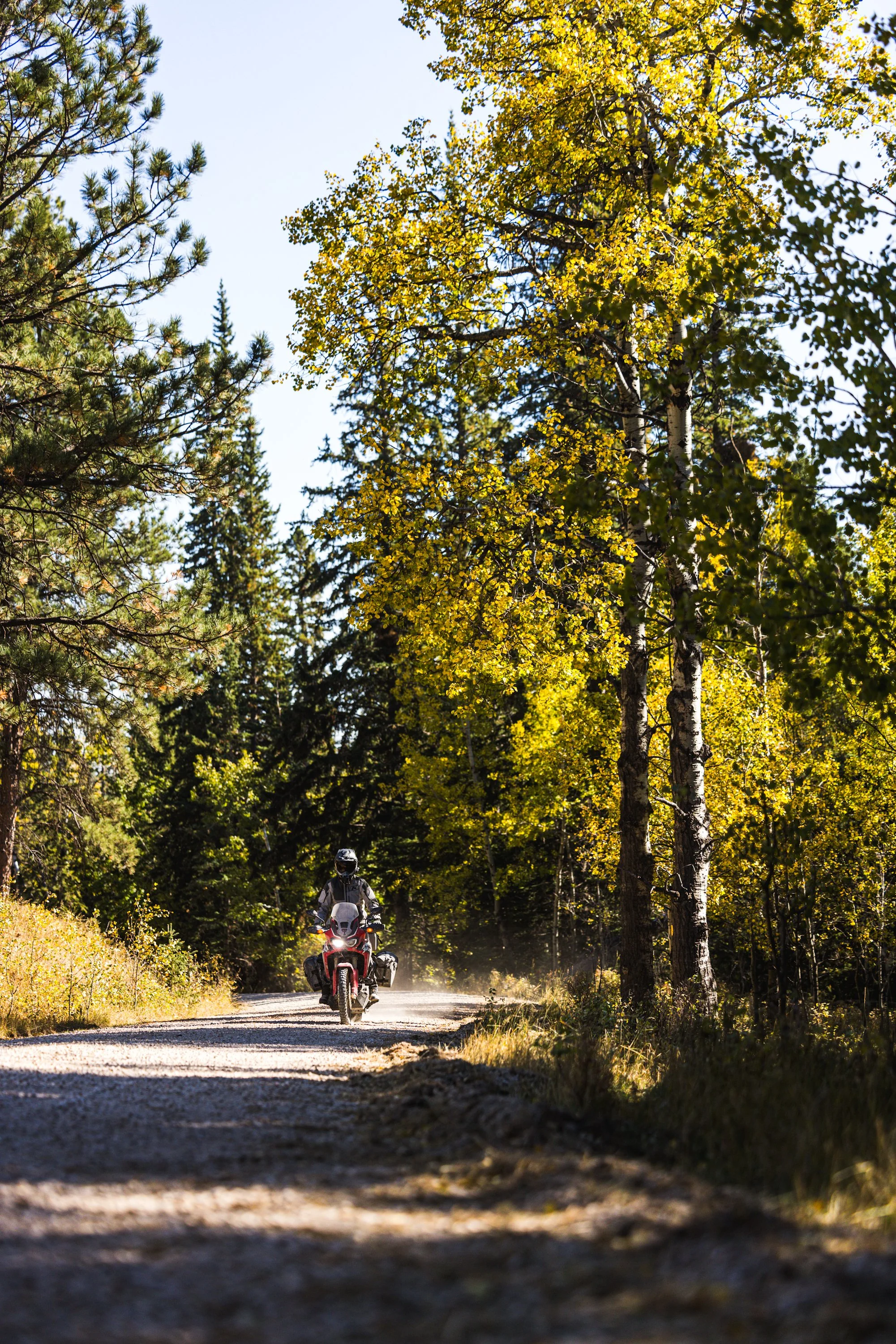
We finished our South Dakota residency in a sea of yellow grass with a strip of cottonwood trees growing along the Little Missouri River. Jerod and I crossed Boxelder Creek and entered North Dakota. We rode along a pink gravel road that dissected the rugged and layered hills of North Dakota’s Badlands.
We stopped briefly in the quaint town of Medora, just outside of Theodore Roosevelt National Park, and finished the day at the Elkhorn Campground in the Little Missouri National Grasslands, a truly spectacular part of North Dakota.
Simon was filming as we recapped our day and abruptly stopped shooting. “Guys, the northern lights are going off behind me,” he said. The next several hours were spent with cameras on tripods and necks craned toward the heavens as the lights pulsated in the star studded sky. It was a fitting end to our last night in tents.


Dispatch 13: Edgemont to Buffalo
The morning air was chilly. I put on my moto gear, rolled out of my tent, and set up my camp chair to brew coffee. We are on a gentle hill at the crux of a congregation of pine covered mountains around us. We lingered at camp this morning, enjoying coffee and toasted homemade cinnamon bread.

The morning air was chilly. I put on my moto gear, rolled out of my tent, and set up my camp chair to brew coffee. We are on a gentle hill at the crux of a congregation of pine covered mountains around us. We lingered at camp this morning, enjoying coffee and toasted homemade cinnamon bread.
As we rode along the red bluffs of the Black Hills National Forest, a Cat Stevens song played in my head. “Oh baby, baby it’s a wild world…” We were in the wilds of South Dakota’s Black Hills, but this whole trip has been a wild dive into an exotic world of unknown locales along the Great Plains. Jerod and I have been smiling the whole way. Those smiles have opened doors. Folks feel our stoke and are always eager to share their stories with us.
Cat Stevens warns in the rest of his song, though, that “it’s hard to get by just upon a smile…”And, the tourist town of Custer wanted nothing to do with ours. The restaurants were shutting down for the season. We found a lunch place, and they immediately told us all the things they didn’t have and took our orders with haste. They didn’t care where we had been or where we were headed.
Jerod and I found our smiles again as we rode through the forest. The quaky aspen trees applauded with their yellow leaves shimmering in the light breeze. They were happy to see us! We took a brief break at Deerfield Lake and rode through Spearfish Canyon, following a slow line of cars as we headed into Spearfish, the city. The leaf peepers were taking in the fall color.
The sun set and temperature dropped as we rode north out of Belle Fourche. We made a brief detour along a dirt road to the geographic center of the 50 United States and stood in the middle of a dark prairie on a remote road. An American flag flapped in the wind. It was serene and beautiful.
Heading north, the temperature dropped to the 40s, and at our 65 mile per hour pace, I was chilled to the bone. We pitched our tents at the Three Toes RV Park in Buffalo, South Dakota. Their shower did not require coins, and I took full advantage of the endless hot water.


Dispatch 12: Lake Ogallala, Nebraska to Edgemont, South Dakota
This morning, we rode across the dam for Lake McConaughy. To our right was 30,000 surface acres of water. It was an unbroken plane of blue, and I have to say, the view was alright, alright, alright. To our left, we could see last night’s campground. Jerod and I talked over our helmet comms. We agreed that it’s unnerving to sleep next to a wall of earth with an immense amount of water pushing against it.

This morning, we rode across the dam for Lake McConaughy. To our right was 30,000 surface acres of water. It was an unbroken plane of blue, and I have to say, the view was alright, alright, alright. To our left, we could see last night’s campground. Jerod and I talked over our helmet comms. We agreed that it’s unnerving to sleep next to a wall of earth with an immense amount of water pushing against it.
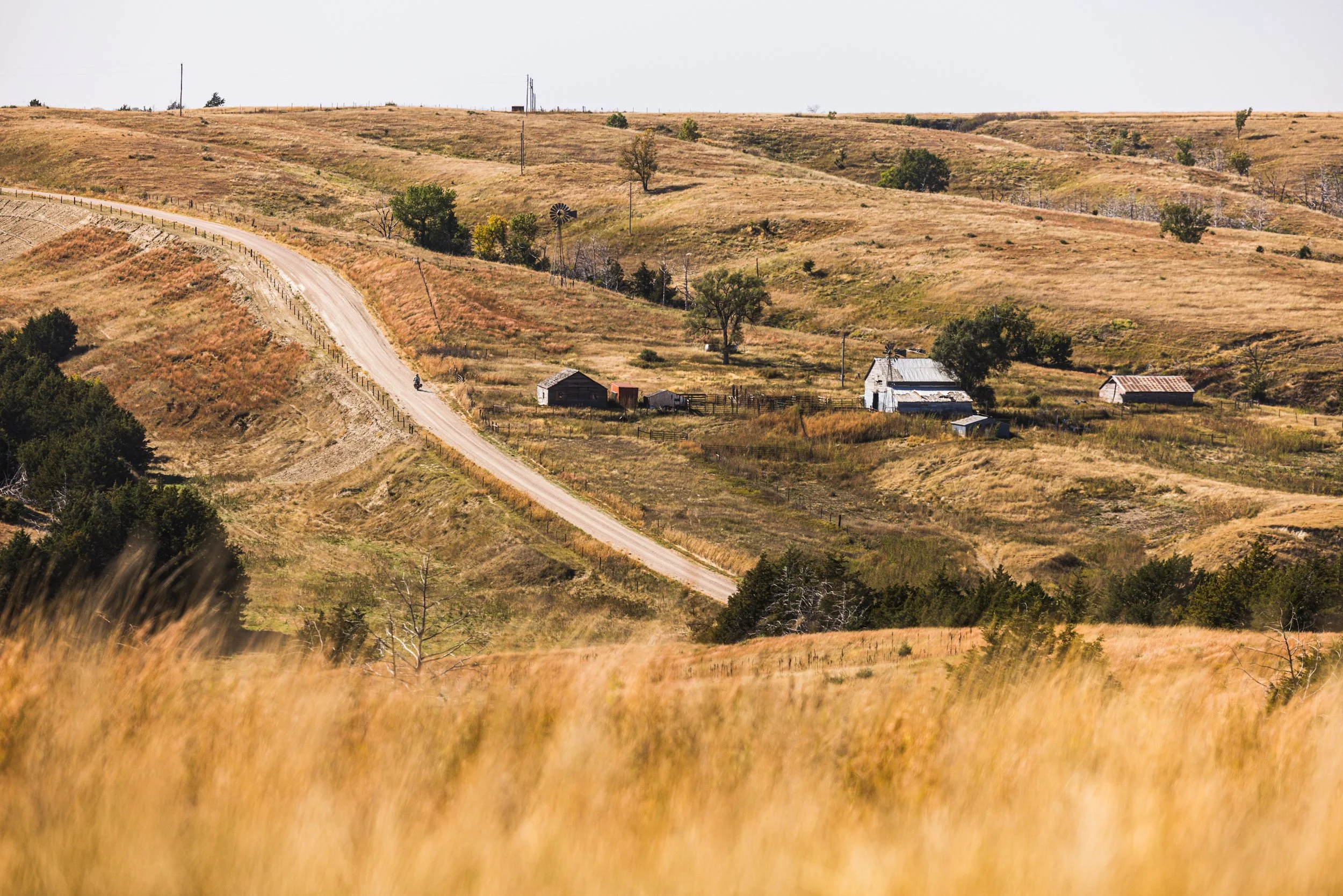
We sat down at the Oregon Trail Trading Post in Lewellen, Nebraska, for over-easy eggs, hash browns, bacon, and one biscuit. It’s my go-to breakfast on this trip, and we needed the calories as we rode into the Sandhills of Nebraska. The dunes bubble across the landscape. Short prairie grass grows on the rolling hills, helping stabilize the grainy soil. The dirt roads are loose, sandy, and incredibly difficult to ride. We rode 40 miles of this unforgiving surface, wrestling our heavy machines the entire way.
We rode through Alliance and stopped at Carhenge, a replica of Stonehenge but with gray painted cars. I’ve never been to Stonehenge, but I know there’s a bit of mystery of why and how? Carhenge evokes that same sense of wonder.
We rode through the Pine Ridge National Recreation Area. The contrast was abrupt as we went from the Sandhill prairies to the towering pines,dramatic bluffs, and rock spires of the Nebraska National Forest.
We passed through the Oglala National Grasslands as the sun started to set. We entered South Dakota under the night sky and rode an expected section of dirt all the way into Edgemont. We grabbed a quick burger at the Yesway convenience store in Edgemont and climbed into the Black Hills National Forest in search of dispersed camping. Jerod got stuck on a loose climb, and I dismounted to give him a push. It was around 10 p.m., and everything outside beyond headlights was pitch black. When I remounted and started the climb, I got off center and dropped 600 pounds worth of motorcycle. Jerod helped me upright my steed, and we proceeded to our camp along Red Canyon. It was midnight before I crawled into my sleeping bag, exhausted but elated for what the morning light would reveal.


Dispatch 11: Johnson Lake SRA to Lake Ogallala SRA
Zane Hoeslton, a maintenance worker for the city of Eustis, Nebraska, was driving through downtown when he saw two guys on adventure motorcycles. Jerod and I were looking for a place to grab breakfast. Zane owns four Kawasaki motorcycles, so he stopped and asked us where we were headed? The sign on the door of his Chevy pickup read, “Village of Eustis—Sausage Capital—You’ll Love our Wurst.” Surely the sausage capital had a breakfast joint. Zane said no, but we might find some local sausage to cook later at the H&J Grocery and Beverage. It was a community hangout with a coffee bar, tables, and some grab-and-go lunch items. I ate a ham and cheese wrap and a whole bag of spinach.

Zane Hoeslton, a maintenance worker for the city of Eustis, Nebraska, was driving through downtown when he saw two guys on adventure motorcycles. Jerod and I were looking for a place to grab breakfast. Zane owns four Kawasaki motorcycles, so he stopped and asked us where we were headed? The sign on the door of his Chevy pickup read, “Village of Eustis—Sausage Capital—You’ll Love our Wurst.” Surely the sausage capital had a breakfast joint. Zane said no, but we might find some local sausage to cook later at the H&J Grocery and Beverage. It was a community hangout with a coffee bar, tables, and some grab-and-go lunch items. I ate a ham and cheese wrap and a whole bag of spinach.
We rode through the Loess Canyons in central Nebraska. The gravel road meandered through a life-sized topographical map of abrupt folded hills. Jerod and I stopped to herd a lone calf off the road and back into a fenced pasture.
Large hackberry trees and red cedar are prolific in the Loess Canyons. Landowners have dubbed red cedar, “the green glacier,” and routinely conduct prescribed burns to control its encroachment on the Great Plains.
We stopped at Potter’s Pasture, a 1,400-acre parcel of private land for open to public use with 32 miles of hiking and biking trails. Steve Potter, a North Platte attorney, established the Pasture so everyone could experience the Loess Canyons. Steve passed away in 2019, but friends Paul Brasby and Steen Nichols, alongside other stewards, carry on his legacy.
We left Potter’s Pasture and picked up Government Pocket Road. Its surface was minimally maintained per the Nebraska road sign. I gave my bike a little extra throttle, spun the rear tire, and dirt tracked around a sweeping curve. I can take or leave the Runza sandwich, but Nebraska, you had me at minimum maintenance road.
We followed canal roads to the Sutherland Reservoir where the bubbler, a raging waterfall over the reservoir’s spillway, flowed back into the canals. Two anglers stood on the shore at the base of the rapids, hoping to catch some walleye.
We camped at the Lake Ogallala East Campground, where we used coin-operated showers. Above us loomed the massive dam for Nebraska’s largest reservoir, Lake McConaughy.


Dispatch 10: Lincoln to Johnson Lake State Recreation Area
We stopped in Seward at the world’s largest time capsule, which is topped by a white concrete pyramid. The underground capsule was sealed in 1975, and the pyramid was added in 1983. There are over 5,000 artifacts inside, most notably a Chevy Vega, no mileage, and Kawasaki motorcycle, also no mileage. It will be opened next year on July 4th.

We stopped in Seward at the world’s largest time capsule, which is topped by a white concrete pyramid. The underground capsule was sealed in 1975, and the pyramid was added in 1983. There are over 5,000 artifacts inside, most notably a Chevy Vega, no mileage, and Kawasaki motorcycle, also no mileage. It will be opened next year on July 4th.
Wabi-sabi is the Japanese aesthetic that finds beauty in imperfection. Our days are spent steeped in the dust of the roads we traverse. The bikes are filthy, and we’re grimy. It is a beautiful imperfection.
Today was extra dusty. Nebraska’s gravel roads are well worn from the trucks that transport corn, sorghum and soybean from the fields to grain elevators and ethanol plants. The base material of these roads consists of pebbles and powdered limestone. It was the first time we’d seen that mix of aggregate, and riding through it was like skiing in slush.
We stopped along a gravel road where haul trucks convoyed from a soybean field. Jerod took pictures of grain pouring from a harvester to a large buggy pulled behind a tractor. We rode into the field and struck up a conversation with Steve Rafert, the farmer orchestrating the dance of machines in the field. “The soybeans will tell you when they’re ready to be picked,” he said. He explained that if the plants were too wet, they’d start to clog the combine and you’d feel it at the controls. He instantly related to our machines telling us he and his son rode dirt bikes. The motorcycle is the great conversation catalyst. We left Steve to his work.
We crossed the shallow and braided waters of the Platte River and stopped for dinner in Kearney at Runza, a Nebraska institution. A runza is a sleeved, rolled sandwich with ground beef and sauerkraut.
We finished our day on another Nebraska delicacy, the minimum maintenance road. Yep, it’s a dirt road that receives minimal maintenance, and they are spectacular. Our last bit of earthen pathway undulated through cuts across folded grasslands. Its surface is narrow, smooth, and grooved with the tracks of vehicles that have gone before us. It is the most beautiful imperfection I’ve ever seen. Wabi-sabi.
I crawled into my tent along the grassy banks of Johnson Lake and dreamt about minimum maintenance roads.


Dispatch 09: Blue Springs to Lincoln
Last night, we parked the bikes under Feit Memorial Park’s pavilion. It had lights and electricity, an unusual perk for tent camping. We charged phones, helmet comms, Jerod’s camera batteries, and with the pavilion lights, we inspected Jerod’s front fork. When we rose this morning, there was a small pool of dark oil next to his tire.

Last night, we parked the bikes under Feit Memorial Park’s pavilion. It had lights and electricity, an unusual perk for tent camping. We charged phones, helmet comms, Jerod’s camera batteries, and with the pavilion lights, we inspected Jerod’s front fork. When we rose this morning, there was a small pool of dark oil next to his tire.
I find most problems are best solved with hashbrowns. We rode into Beatrice, Nebraska, and stopped for breakfast at the Country Cookin’ Café, an expansive, subterranean diner under the Nebraska Baseball Hall of Fame. Over easy eggs, hash browns, bacon, and coffee poured from a bronze-colored pot arrived in short order. You may remember that I spoke of eating better yesterday. Well, all’s fair in love and a diner breakfast.
Back to our fork conundrum, Jerod and I decided we needed to consult an expert. With only 85 miles scheduled today, there was plenty of time to hit a motorcycle shop in Lincoln.
To expedite things, we rode Highway 77 straight into town. Vast fields of corn, sorghum, and soybean bordered both sides of the highway. Massive combines roamed the stalks, transforming the plants to grain as trucks waited to haul off each machine’s bounty.
Rod’s Power Sports appeared on our left. Honda’s prominent winged logo was displayed on their sign. We’d just lucked into one of the largest Honda motorcycle dealerships in Nebraska.
Dylan, the shop’s service tech, gave us his prognosis. If the fork continued to lose oil, the damage would be extensive, and it was dangerous to have oil leaking on your brakes and tire. They had the parts to fix it, and Dylan went to work. Thank you, Rod’s Power Sports! Jerod and I set up on the showroom floor to edit photos and write dispatches. A pair of shiny, new Honda Africa Twins sat next to us. It was tempting until I realized both had automatic transmissions.
We snapped a group photo with the dealership staff, and they sent us away on our dirty and very used Africa Twins. We camped northwest of Lincoln along the shore of Branched Oak Lake and stood on a sandy beach as the sun dropped below the horizon. The brilliant orange hues coupled with striated clouds and aircraft contrails transformed the sky into a static portrait of fire.


Dispatch 08: Council Grove, Kansas, to Blue Springs, Nebraska
Our first miles of gravel featured a caravan of small buttes and mesas that rolled across the horizon. Bursts of yellow peppered the hills around us. Fall is quietly descending upon Kansas. We traveled on Blue Stem Road and took a long diversion on Little Egypt Road through tall grass prairies interspersed with densely wooded bottoms. Toto, we’re in Kansas, and I’m in love.

Our first miles of gravel featured a caravan of small buttes and mesas that rolled across the horizon. Bursts of yellow peppered the hills around us. Fall is quietly descending upon Kansas. We traveled on Blue Stem Road and took a long diversion on Little Egypt Road through tall grass prairies interspersed with densely wooded bottoms. Toto, we’re in Kansas, and I’m in love.
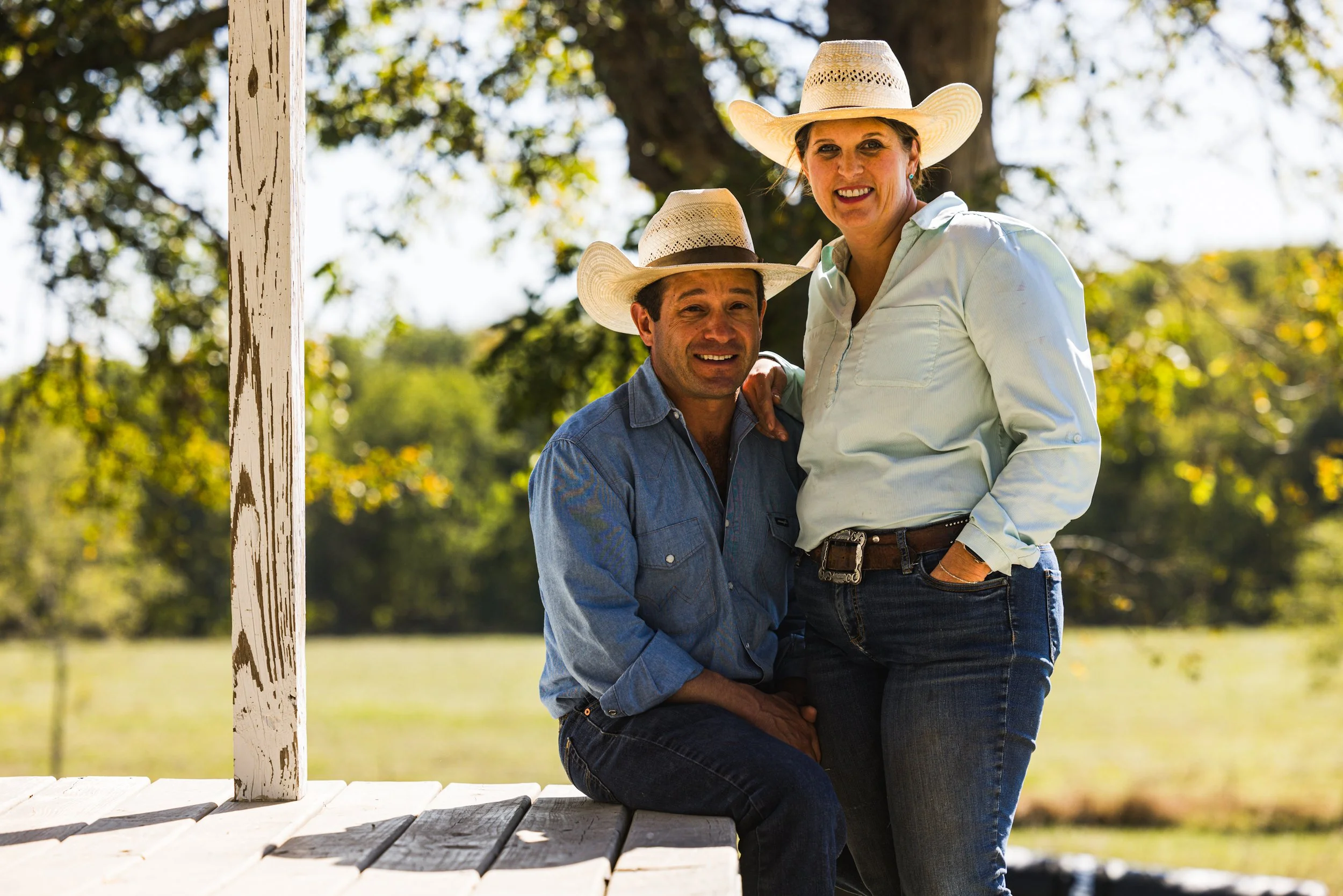
We crossed Mills Creek through a thicket of trees and stopped outside of Alma to have lunch with two of Jerod’s friends. Arturo and Wrenn Pacheco are Kansas ranchers that sell their pasture-raised beef direct to the consumer. They graciously invited us into their home, grilled us all beef hot dogs, and chatted about ranch life in Kansas. Before we left, Wrenn pulled a couple of Kansas City strip steaks from their freezer, and Arturo told us exactly how to cook them.
We made a brief stop in Volland, where the old red brick general store from the 1900s has been transformed into an art gallery.
Before we started this trip, I made a pledge to maintain a decent quality of food consumption. I have failed. Convenience store breakfast burritos, that Clarendon Sonic Drive-In visit, and a couple of Subway stops have left me void of proper cuisine. With the Pacheco beef, I devised a gourmet meal for tonight’s camp. We stopped at a grocery store in Wamego, where I bought a red bell pepper, green onions, and frozen veggies to keep the steaks cold in my saddle bags.
Making a pit stop for coffee, we discovered Jerod’s front suspension fork was leaking oil on his brake calipers. It was a mechanical development that had the potential to be catastrophic.
We passed through farmland with round bales of hay waiting in empty green fields. The caliche road had recently been graded and there was a layer of silt spread amongst golf ball sized rocks. Our large motor bikes churned the silt and produced an ethereal cloud of dust that enhanced the setting sun’s golden light. I felt cozy and connected to this place as I careened across its chalky thoroughfares.
We quietly entered Nebraska and camped at Feit Memorial Park in Blue Springs, Nebraska. I finished thawing the steaks by resting them against my bike’s warm engine. They were delicious, and the veggie sides fulfilled my quest to eat better.
Jerod’s leaking fork seal would have to wait until tomorrow.


Dispatch 07: Beaumont to Council Grove
Today, calamity ensued. Our first dirt of the day was a scruffy piece of double-track through thigh-high ragweed. The path beneath us appeared and disappeared under a blanket of weeds. Suddenly, Jerod dropped in and out of a knee-deep hole. He popped out of the seat like a whack-a-mole. The inertia pitched him back, and he couldn’t help but twist the throttle. It was a full-on rodeo, and Jerod was along for the ride. His motorcycle turned and headed straight for a barbed wire fence. Jerod stopped it just in time. “I thought you were done for,” I said. Jerod looked at me, back to the five wires strung on t-posts, and said, “I was more worried about having to fix that rancher’s fence.”
Today, calamity ensued. Our first dirt of the day was a scruffy piece of double-track through thigh-high ragweed. The path beneath us appeared and disappeared under a blanket of weeds. Suddenly, Jerod dropped in and out of a knee-deep hole. He popped out of the seat like a whack-a-mole. The inertia pitched him back, and he couldn’t help but twist the throttle. It was a full-on rodeo, and Jerod was along for the ride. His motorcycle turned and headed straight for a barbed wire fence. Jerod stopped it just in time. “I thought you were done for,” I said. Jerod looked at me, back to the five wires strung on t-posts, and said, “I was more worried about having to fix that rancher’s fence.”
The Flint Hills of Kansas are world renowned in the sport of gravel cycling, and the UNBOUND Gravel race, which is held every June in nearby Emporia, is the sport’s premiere event. We rode along sections of the racecourse through green crumpled hills that drain into picturesque reservoirs. Occasionally, we encountered small, pronounced grass peaks that looked like they were plucked out of a Dr. Seuss book. Shards of flint clattered under our knobby tires and into our skid plates. Sunflowers lined the sides of the road and slapped against our hand guards as we fought to ride a straight line through the loose rock.
The land pushed us through its rollers and creek bottoms, picking our destiny for us. We found ourselves riding atop a soft ridge, past the pumpjack on Texaco Hill. Trees were sparse and the sun intense. We descended into the dry bottom of Canning Creek for a break in the shade. I sat down and leaned against my bike’s rear tire and instantly knew something was wrong. It was flat. These big motorcycles have chunky, non-compliant rubber. It took over an hour to replace the punctured tube. When prying the tire back on the rim, I pinched the new tube with a tire tool. It took another hour to replace it.
We stopped at Silvia’s Taco trailer in downtown Emporia and ate dinner with filthy, rubber-marked hands. We camped northwest of Emporia along the shores of Council Grove Lake. For a land locked tour, we’ve seen a lot of shoreline.


Dispatch 06: Stillwater, Oklahoma, to Beaumont, Kansas
I crawl out of my tent and jump on the motorcycle first thing in the morning. The comfort and quiet of a car would be nice, but the vulnerability of the open cockpit instantly connects you to a new place. When you meet other riders on the road, they drop their hand low, palm facing forward, and give the two-wheeled wave. The camaraderie of motorcycle travel never gets old.

I crawl out of my tent and jump on the motorcycle first thing in the morning. The comfort and quiet of a car would be nice, but the vulnerability of the open cockpit instantly connects you to a new place. When you meet other riders on the road, they drop their hand low, palm facing forward, and give the two-wheeled wave. The camaraderie of motorcycle travel never gets old.
We broke camp earlier and fast. No coffee was brewed, so we stopped for java at Aspen Coffee Company in downtown Stillwater. We had skipped our morning routine to prepare for a guest. On this trip, we’re interviewing people of the plains, and today Jerod and I had the honor of visiting with Chief Geoffrey Standing Bear, the leader of the Osage Nation and great grandson of Chief Lookout.
We met with the chief in Pawhuska, Oklahoma. He asked us if we’d read the book, Killers of the Flower Moon. We said no. “If you consider yourself real journalists, you’ll read the book,” he said. It’ll be the first thing I read when I get home. The conversation was thoughtful and enlightening. He told us how the Osage have developed a syllabary to represent a written form of their language. All the signs in Pawhuska have English letters and the Osage syllabary. Before we left, the chief showed us the greenhouses he established so his people would always have access to fresh fruits and vegetables.
We finished the day riding through the Joseph H. Williams Tallrass Prairie Preserve, the largest in the world. None of the 40,000-acres along the sea of grass has ever seen a plow. It was magical to ride through the rolling hills and curved gravel roads of this untouched prairie.
We straddled the Oklahoma/Kansas border before turning left into Kansas and shortly dropped into a low water crossing for the Elk River. We were stopped by high water flowing across the road. Averse to dropping and wrestling our massive two-wheelers in a moving river, we stopped and scouted a shallow route on the edge of Osro Falls, where the water cascaded off the roadway. We finished the day at the fly-in Beaumont Hotel where we set up tents on the hotel’s grass lawn and showered in a vacant room. We are in the rhythm of the journey now!


Dispatch 05: Foss to Stillwater
I slept for a solid six hours last night. I feel rested for the first time in four days. We camped on Foss Lake, where this morning I rolled out my travel yoga mat and did a 30-minute flow next to its tranquil waters. Rejuvenated and rested, I mounted my motorcycle and followed Jerod out of the park. To our right, we saw the first signs of what the day’s dirt held for us: a freshly plowed field the color of red velvet cake. It looked delicious.

I slept for a solid six hours last night. I feel rested for the first time in four days. We camped on Foss Lake, where this morning I rolled out my travel yoga mat and did a 30-minute flow next to its tranquil waters. Rejuvenated and rested, I mounted my motorcycle and followed Jerod out of the park. To our right, we saw the first signs of what the day’s dirt held for us: a freshly plowed field the color of red velvet cake. It looked delicious.
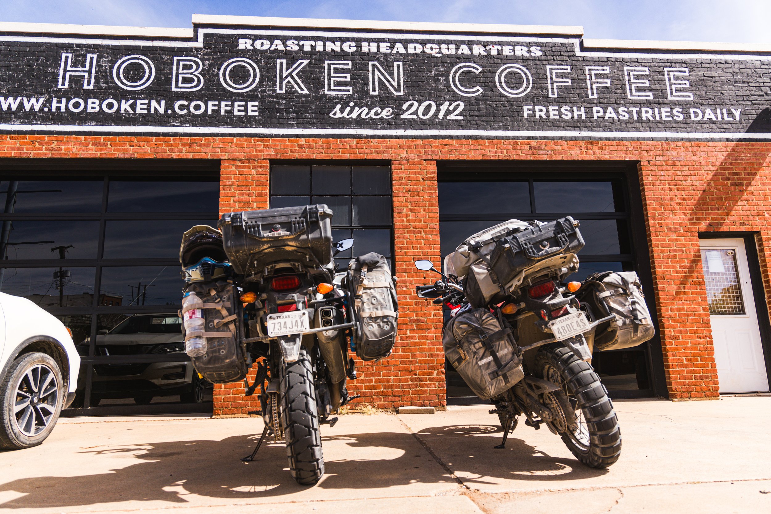
We stopped for breakfast burritos at a Phillips 66 gas station in Weatherford, Oklahoma, got our kicks and a few miles on old Route 66, and found our first dirt roads for the day. As Jerod’s rear tire transitioned from pavement to gravel, it kicked up tiny swirling dust devils. We crossed the Canadian River and rode into Guthrie where we stopped at Hoboken Coffee for drip brew and Wi-Fi. I broke away for a bit to explore Guthrie’s bustling downtown square and sauntered into A Novel Idea, a bookstore with two free ranging basset hounds, Miss Lizzie and Mr. Darcy. I’m missing my wife and our hound dogs something awful. I dropped to the ground for some surrogate hound love.
We proceeded north out of Guthrie and onto the finest red dirt roads Logan County offers. Our tires hushed as we floated across a velvet-smooth, crimson-colored road. Puffs of red clouds emitted from Jerod’s rear tire like tiny storms on Mars.
It was red dirt, concrete over the Cimarron River, and back to red dirt. We crossed Interstate 35 in the exact same manner utilizing a backroad concrete overpass.
We picked our first double track road of the trip heading towards Stillwater, two red strips of earth with a green center of foliage. Jerod and I took our prospective sides of the road as it curved up, down, and through an arched canopy of trees. Stillwater appeared on the horizon. We rode past patinaed brick downtown buildings filled with quaint shops and busy restaurants.
We arrived at the shores of Lake McMurtry, set up camp, and watched the sun paint the horizon and waters a brilliant orange.


Dispatch 04: Quitaque, Texas, to Foss, Oklahoma
This is a 15 day trip. We are on the motorcycles from dawn to well past dusk, and every night is spent in a tent. You must create little moments of solace. I call them micro vacations. I slept five hours last night. This morning I showered for the first time in three days. Micro vacation.

This is a 15 day trip. We are on the motorcycles from dawn to well past dusk, and every night is spent in a tent. You must create little moments of solace. I call them micro vacations. I slept five hours last night. This morning I showered for the first time in three days. Micro vacation.
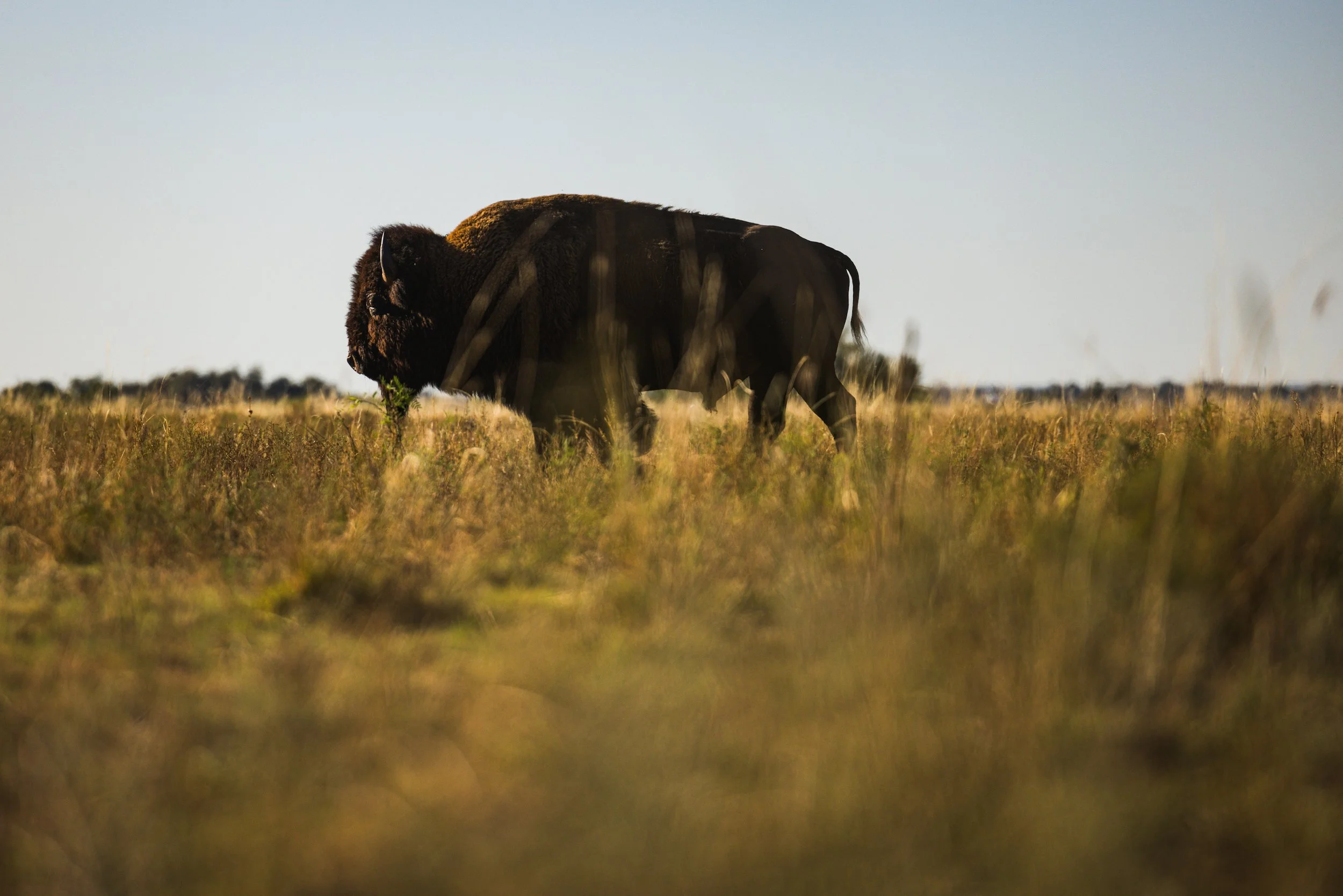
A herd of bison meandered around the Caprock Canyons State Park headquarters. Two bulls playfully tussled on the sidewalk under mesquite trees. Jerod and I left them to it, exited the park, and rolled gravel immediately. Jerod surged ahead roosting through the ruts and rock ledges like an expert. We rode parallel to the park’s boundary as the sun shimmered off the red cliff faces on the horizon. It was back to asphalt as we rode over the rust-colored mud of Prairie Dog Fork Red River.
The meat of today’s adventure sandwich was the county road through the historic JA Ranch. A 30-mile public path through private land. The red dirt path dissects the 190,000-acre ranch through cuts, breaks, and dry creek crossings. We met ranch hands in pickups and long stretches of sand—both unimpressed by our presence. Jerod takes another spill in the sand. Our journey across the JA Ranch took three hours. We exited the property and climbed the Caprock Escarpment along a road called Koogle’s Jump Off.
Breakfast this morning was sparse and coffee nonexistent. I hit Clarendon famished and Jerod had a pounding headache. It was 3 p.m., and I couldn’t stomach another convenience store lunch. Our only other option with the time we had was a Sonic Drive-In where we woofed down a couple of burgers next to our motos in a stall meant for a car.
We rode through Wheeler, Texas, to the sound the Mustang’s gearing up for football under the Friday night lights and punched through the Oklahoma border under the dark of the night. Goodbye, Texas.
We stopped in Elk City where kids still cruise a drag in pickups with loud pipes and motorcycles with even louder exhaust tips.
Camp was made in the green grass next to the waters of Foss Reservoir. I crawled into my tent and immediately fell asleep.


Dispatch 03: Colorado City to Quitaque
With only four hours of sleep last night, I woke disheveled, packed my gear, and went to fire up the motorcycle. My key was missing. It was packed inside my tent, which was two bags deep on top of my pillion seat. After a quick unpack and repack, Jerod and I departed Lake Colorado City State Park.

With only four hours of sleep last night, I woke disheveled, packed my gear, and went to fire up the motorcycle. My key was missing. It was packed inside my tent, which was two bags deep on top of my pillion seat. After a quick unpack and repack, Jerod and I departed Lake Colorado City State Park.
We rode past the park entrance along asphalt. As the road curved we went straight and picked up a nicely groomed and graded caliche road. My spirits rose. I grew up in nearby Snyder. This is the flora and topography of my youth. Scrubby mesquites mingled amongst, water filled cattle tanks, buttes and small mesas. We stopped in Coahoma for breakfast burritos at the Stripe’s convenience store.
We leave Coahoma and ride Interstate 20’s service road to avoid the horde of Permian Basin big rigs and oil patch traffic. We passed the rusted and gnarled tubes of Big Spring’s refinery, veer northwest and attacked today’s gravel roads.
A dip. A crest. And then sand. More dips, more hills, and more sand. It takes a certain finesse to navigate a nearly 600-pound moto and gear through rutted sand. Jerod went down in a graceful, slow-motion tumble. It took both of us to lift his beast of a machine.
We stopped at the Lamesa Rodeo grounds where in the 80s I used to compete in motorcycle rodeos: barrel racing, pole bending, long jump, and a wheelie contest, which I won.
Next we made a detour through Lubbock, through the Texas Tech campus, and around Memorial Circle and deeper up the Plains.
Outside Floydada, we dipped in and out of Blanco Canyon, passed playa lakes, and through the sentinels of the plains, the wind turbines.
Our bikes descended the Caprock Escarpment along the guardrail curves of FM 689 and hit Quitaque at dark. Our campsite was at the back of Caprock Canyons State Park. The air cooled as we descended into the canyon. Massive shadows appeared on our right! A few of the park’s bison were lumbering in the ditch. We pitched tents at Little Red campground. It was another late night, and it will be another early morning. I’m not sure I can keep up this pace.


Dispatch 02: Pandale to Colorado City
We were up before the sun and wasted no time getting started. It was instant coffee, a hand full of granola and back on the bikes for the longest leg of the trip. 368 miles were on the books. We made a quick stop at the limestone bed of the Pecos River before exiting the Pandale Crossing River Resort. The water flowed on either side of us. The current quickened as it flowed under a long forgotten concrete bridge.

Day 02: We were up before the sun and wasted no time getting started. It was instant coffee, a hand full of granola and back on the bikes for the longest leg of the trip. 368 miles were on the books. We made a quick stop at the limestone bed of the Pecos River before exiting the Pandale Crossing River Resort. The water flowed on either side of us. The current quickened as it flowed under a long forgotten concrete bridge.
We rode out of the river basin on a gravel road that quickly turned to chip seal. Ozona was our first stop. We downed a couple of breakfast burritos, exited Ozona, and crossed Interstate 10 into Texas backroad bliss. The road serpentined over hill and dale through thick live oak groves and across rolling horizons that only served more flowing asphalt. But, the rhythmic road was lulling me to sleep.
Iced coffee was had in Sonora along with some pushups to shake the sleep from my head.
After Sonora, we navigated long sections of gravel through mature live oaks. Recent rains had filled the low spots with water crossings. I gave my throttle an extra twist and splashed each puddle we encountered. Our trajectory took us north to the Historic Fort McCavett. Its towering chimneys and crumbled wall were perched perfectly on a hill above the road. We had no time to explore, though. The light was starting to fade.
We stopped at Eden and devoured some exotic jerky from Venison World. The attendant at the gas station warned us about deer encounters as dusk approached. She pointed to her truck, the front concaved inward like she’d met the wrong side of a boulder.
Caution heeded, we finished up our last gravel of the day. It felt like an endless convoy of right turns as we traversed more rural Texas back roads. A massive solar farm rose from an open pasture. It was an endless quilt of mirrored panels in nowhere Texas. Darkness caught us before we finished our last bit of dirt. We diverted to pavement and stopped 70 miles later for dinner at an Allsup’s. I had a turkey sandwich embedded in a plastic triangle.
We rolled into camp at Lake Colorado City State Park. It was dark, but I knew this park well. It was the first state park my grandparents took me to as a kid.


Dispatch 01: Presidio to Pandale
Day ONE: We rose before dawn by the light of a thunderstorm erupting across the Chihuahuan Desert. A cold front chilled the desert morning. The storm sat atop Casa Piedra Road and drenched it’s gravel surface. That 50-mile-long piece of our day’s route, with its sandy creek beds, would be too arduous for our heavy adventure bikes.

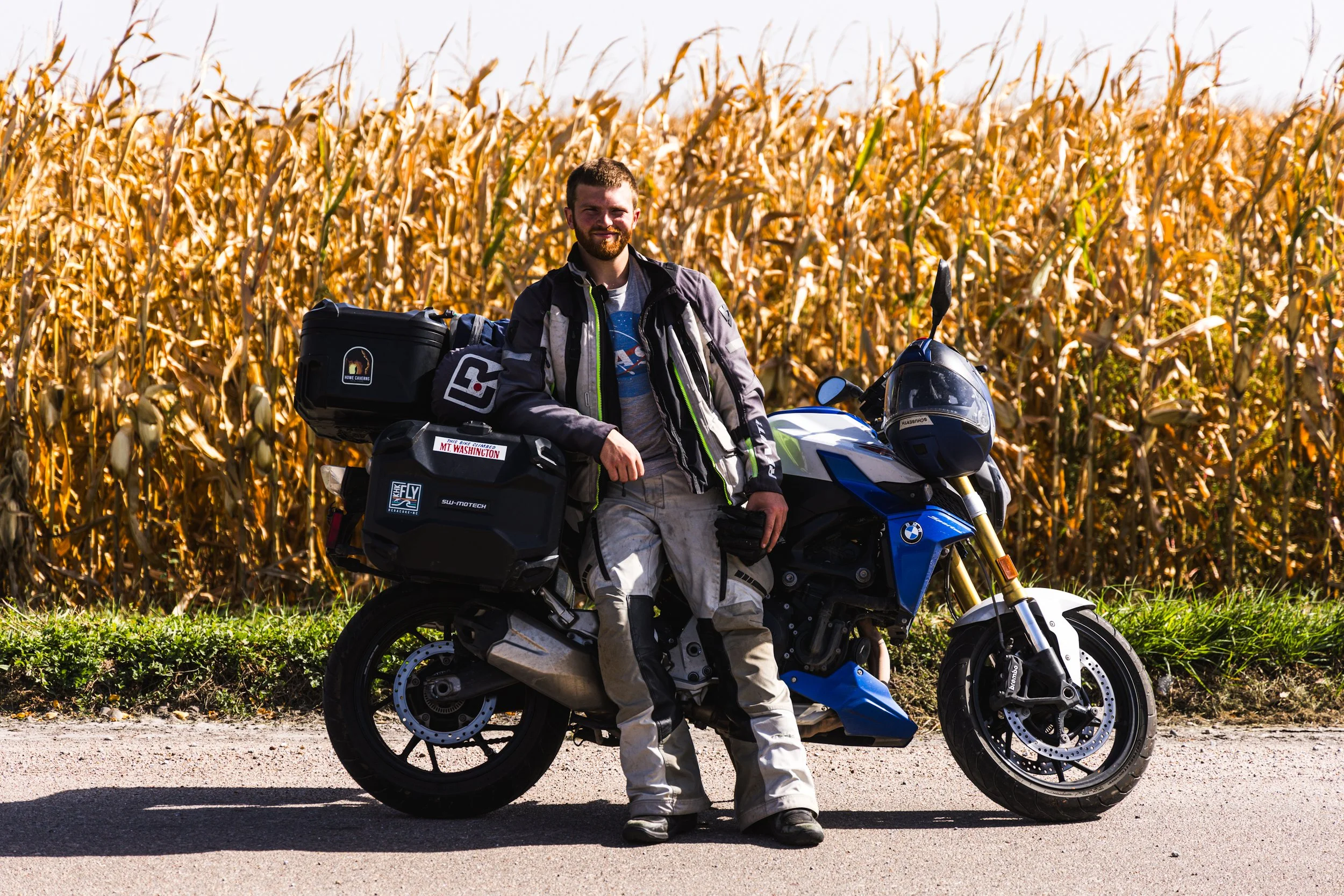
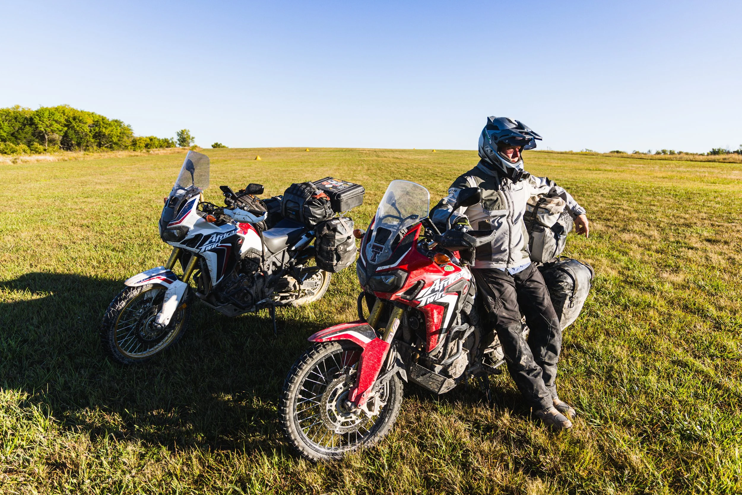
This is the Great Plains Project, and I’m Brandon Weaver. Photographer Jerod Foster and I are riding motorcycles 3,500+ miles from Presidio, Texas, to Fortuna, North Dakota, right through the middle of America.
Day ONE: We rose before dawn by the light of a thunderstorm erupting across the Chihuahuan Desert. A cold front chilled the desert morning. The storm sat atop Casa Piedra Road and drenched it’s gravel surface. That 50-mile-long piece of our day’s route, with its sandy creek beds, would be too arduous for our heavy adventure bikes.
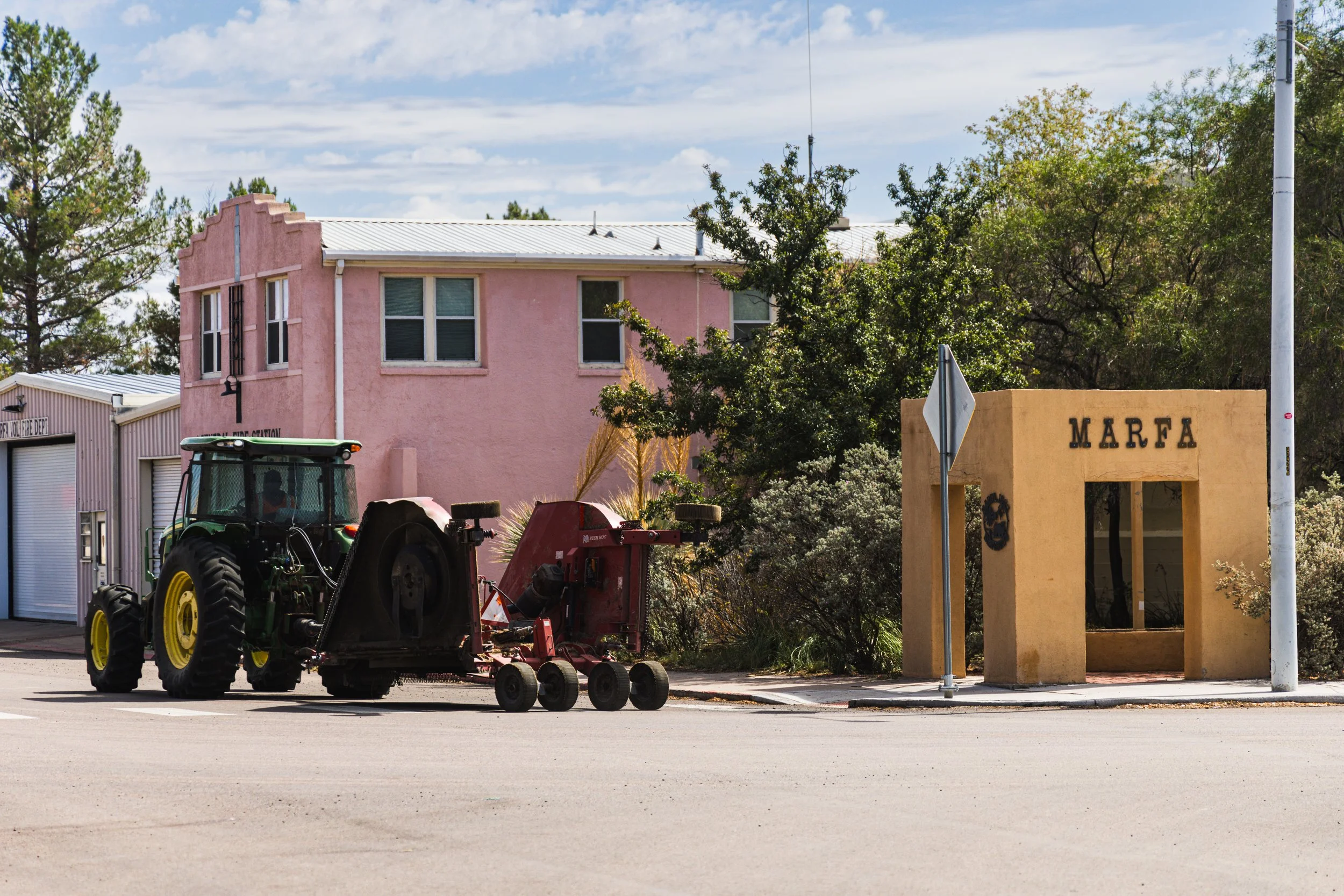
We diverted to Highway 67 to Marfa—not a bad compromise—and climbed out of Presidio, dropped through the ghost town of Shafter, and passed the Chinati Mountains. We pulled into the border patrol checkpoint, slowed, gave a nod to the agent, and he waved us through. The ride through Marfa was a display of the town’s past and present. Tractors and stock trailers meandered past the fancy coffee shops, art galleries, and gourmet food bodegas. We moved westward, descending past the remnants of an ancient volcanic eruption, and into Alpine.
After refueling, the air turned hot, but another thunderstorm gathered energy on the horizon. Puffy cotton candy clouds bordered a dark patch of rain in the distance. The smell of precipitation and creosote permeated my helmet. The asphalt glistened, and the air was cool once again.
After Marathon, it was all business. We had big miles to cover for the day’s terminus: the Pandale Crossing River Resort. We headed north out of Langtry on 25 miles of gravel. The caliche road climbed and descended along rocky ridges with soft sloping edges. We were still in the Trans Pecos, but Big Bend was firmly in our past. The first indication of settlement was a speed limit sign—30 mph. A smattering of rustic habitats dotted the hillsides. We stopped on a concrete bridge, the waters of the Pecos River flowing beneath us. We turned off our engines and listened. The sun had just set. The Pecos reflected an ethereal blue sky with wispy clouds. Darkness came quick as we rode into camp and pitched our tents on the banks of the river.


And, So It Begins!
Today is our launch day from Lubbock, Texas, to our starting point in Presidio. It’s 500 miles of tarmac to this beautiful little spot on the Rio Grande, so there’s little time to waste! Tomorrow, the Great Plains Project officially launches—15 days and over 3,500 miles of big skies, dirt conditions, and a pair of friends looking to see some country from a pair of Africa Twins.
Let’s keep this short and brief (because time is of the essence). Today is our launch day from Lubbock, Texas, to our starting point in Presidio. It’s 500 miles of tarmac to this beautiful little spot on the Rio Grande, so there’s little time to waste! Tomorrow, the Great Plains Project officially launches—15 days and over 3,500 miles of big skies, dirt conditions, and a pair of friends looking to see some country from a pair of Africa Twins.
This space is about to see daily updates, so stay tuned!

What is The Great Plains Project?
The North American Great Plains are one of the most important places in the world for the world. I often say this when describing the significance of the Great Plains to folks that have maybe up to that moment just viewed them as a patchwork of fly-over country. I also add that, like many places where there has ever been any human population, it has dramatically changed over time.
The North American Great Plains are one of the most important places in the world for the world. I often say this when describing the significance of the Great Plains to folks that have maybe up to that moment just viewed them as a patchwork of fly-over country. I also add that, like many places where there has ever been any human population, it has dramatically changed over time.
I’m a travel and conservation photographer and a professor at Texas Tech University, and I’ve been obsessed with the Great Plains for a long time. I’m no encyclopedia on the topic, but I’m a curious explorer of place, particularly when its that place that’s been right outside the door for over half my life. That’s why in 2018, I started developing a backroad cycling route from Lubbock, Texas, to Calgary, Alberta. The bicycle is a machine that moves slow enough for the rider to really soak in his or her surroundings, and there is so much more revealed about a place when traversing it from the gravel and no-lane roads that thread their way across its topography compared to the monotonous interstate at 80 mph. Since 2018, I’ve had the opportunity to work on a more formalized version of the route with colleagues from other states in the region, and it is now developed into a forthcoming national recreation gravel cycling route from the Texas/Mexico border to the North Dakota/Canada border.
But, what is the project, you ask? After years of incubating the idea, my great friend, writer, and close collaborator Brandon Weaver and I are setting out on a two-week-long adventure motorcycle journey along the route, riding some 3,500 miles from Presidio, Texas, to Fortuna, North Dakota. Our mission is several fold: to recon the ultimate viability of this long-distance backroad track, to steep ourselves in what and who makes the Great Plains special, and to show everyone that there’s more to the region than just dots, lines, and the occasional town you can make out from their airplane windows. We are modern day explorers saddling steel horses and revisiting a place that has been explored and known over and over by generations of people, a place that represents the American frontier, and a place that without its existence, we’d most likely all be a bit hungrier and less clothed.
Join the journey, and follow this space for more details soon!